AeroShield™ MX280002A RF Drone Detection and Tracking Software : AeroShield Simulator Control : Setting Up Simulator in AeroShield : Simulator User Interface
 
Simulator User Interface
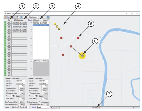
Build a Simulator User Interface using the Simulator Tools as shown in Figure: Build Simulator User Interface.
Build Simulator User Interface
1. Port Column
2. RSM GPS Coordinate Column
3. Tracked Drone Coordinates
4. Drone Track
5. RSM
6. Measure RSM Distance
7. Distance Readout in Meters
Add RSMs
For this procedure, refer to Figure: Build Simulator User Interface.
1. Click a point on the map to place an RSM.
2. Right-click on the map to show the menu shown below. It is best to create at least three probes in a triangulated manner to best capture the drone’s flight within a monitored area.
3. Click Copy Coordinates to Clipboard.
4. Point and paste the coordinates in the coordinates column.
5. Continue to add probes. A maximum of twenty-four probes can be added to the map.